February 5, 2023
After many years of using the old map, the club invested in updating the entire park. Thus far, about 25% is complete, enough to have a great meet! We will be exploring the newly acquired part of the park on the East side of Greensfelde Park.
Registration/check-in: 11am; no starts after 12pm
Start Location: Thanks to our friends at Wyman and Alpine Shop, our meet headquarters will be in the Enterprise Center on the Wyman campus. After entering, take an immediate right up the hill and follow the signs. All registration, starts, and finish are there. Restrooms and an indoor space are provided.
Click to access CAMP-WYMAN-EXPERIENCES-MAP.pdf
Courses available: Three options:
White Course: For beginners; several points around the pond area and large mowed paths. A few points off the trail to get your feet of the path in a very accessible but challenging way. Look for remnants of the Wyman Camp there and enjoy the mix of vegetation. Keep an eye out for shortcuts.
Score O: 23 point, Orange (mid-level) Score O course with a 90 minute time limit challenging you to plan and navigate your chosen course wisely. Any order, penalty for any time over the limit.
Blue Course: point to point, 6.4km, with 330m of climb. This course is built for a winning time around 75 minutes. Get your climb in right out of the gate, but be ready to strategically move through the rest of the course finding balance against climb.
The bags will be on stakes, knee level, using epunch for the Score O and Blue courses. Orienteer to the feature first, not the control marker.
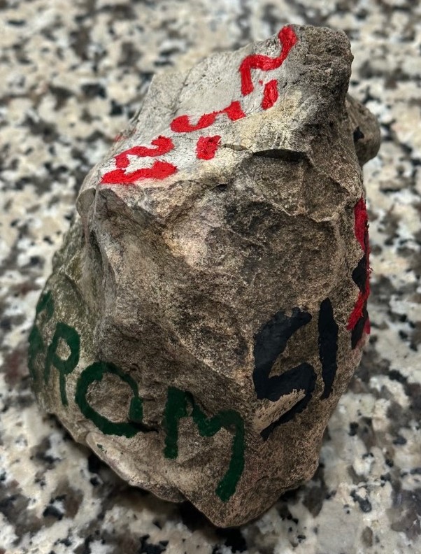
GROM: Combine both the Blue and Score O for double the fun and its own category and a PRIZE for the winner of this combo. The Green Rock Orienteering Master (GROM) will be awarded to the person or team who completes both the Score O and Blue Course in the fastest time. The victor will earn the 1st ever GROM Rock as their prize.
Course notes: The new map is a different take from the SLOC maps you are used to. I find the local SLOC maps have a welcome quality and uniformity to them; likely due to those same folks building the club’s core maps inventory all around the same time. Kudos to all those who have given SLOC such a rich map history.
But this new map is a bit different, and you’ll notice that at first glance. There is a focus on smaller vegetation boundaries and more green X’s and O’s than we have ever seen. Its a chance to test your mind using a whole new set of catching features.
To that end, I have tried to highlight more of those features which we don’t see as much; root stocks take center stage. I found a nice little cave that is tucked away and placed it on the Blue course.
The Score O was built with the moderate level orienteerer in mind. My favorite new valley up off the Northwest part of the field is utilized and is rich with interesting features. The concept of the course moves in a circle around the Wyman property in the newly mapped Greensfelder area and features the “new” Eastern part purchased by the county park system last year.
On Blue you’ll do the whole loop. On the Score O, you may elect to do only the Northwestern corridor as a loop or try for the Southern piece. If you get to South section, you will get a chance to work your way up (or down) through a seldom explored area (for now). There are easier ways through this area, try to find one.
The White course explores the new pond area and wide mowed trials and structures. This is a true White level course for skill but doesn’t short you on distance or paying attention to your map. Take the trip up the hill to see a massive cave. See it now, at some point the park administration will likely close it off. This would be an ideal course for a young orienteerer go out on their own for the first time.
Warning: Keep an eye out for barbed wire, there are several places where it is more common, including above the pond and valley area out of the mowed area.
Safety Bearing: If you are North of the headquarters and the main road, your safety bearing is South. If you are South of the road and Wyman property, your bearing is North. The West bearing will take you to the Scenic Road Dr. in the park. It is off course and you should be heading back East.
Checking In Checking In: No matter how your day in the woods goes, you MUST CHECK BACK IN at the end to let us know you are off the course. You will be REQUIRED to provide you cell number and car license plate before going out on course.
Looking forward to seeing you out there. Thanks to Jarrid, Jason, and Jeff for the Wyman/Apline connection. Thanks to Josh, Bryan, Jeff, and Mark for helping and inspiring.

